Technically, yes, but only recommended for experienced mountaineers. Ideally: a guide and local porters.
An Adventure Beyond the Inca Trail
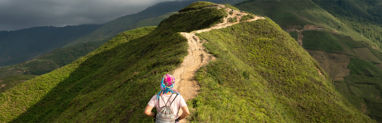
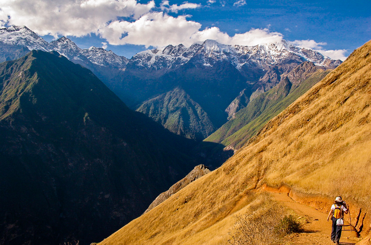
If you’ve ever dreamed of walking an Inca path without the crowds, with the feeling of uncovering what few have seen, the Vitcos–Choquequirao section is your journey. It’s not an easy trek: 7 to 9 days crossing 4,600 m peaks, descending into deep canyons, and climbing endless steps again. But every step is filled with history, mystery, and breathtaking landscapes.
Here you’ll walk where Manco Inca and Titu Cusi resisted the Spanish; you’ll sleep beside rivers flowing down to the jungle; and finally, you’ll reach Choquequirao—the “sacred sister” of Machu Picchu, still protected by the silence of the mountain.
You begin in Vitcos (Rosaspata), once the residence of Inca nobility and the seat of the Neo-Inca State (1537–1572). After the fall of Cusco, the Incas sought refuge here, and nearby lies the Ñusta Hisp’ana (Yurac Rumi) sanctuary—a carved white rock where sacred rituals were performed. Chronicles tell that colonial friars tried to burn it in the 16th century… and the scorch marks can still be seen.
Along the trail, you’ll follow traces of original Inca roads, moss-covered steps, terraces that still channel water, and forests where the Andean cock-of-the-rock sings at dawn.
After several days, you’ll conquer the final climb and Choquequirao will emerge—a vast Inca city set on a plateau at 3,050 m, perched above the abyss of the Apurímac River. Unlike Machu Picchu, there are no trains or buses here: only those who walk can reach it.
It is, quite literally, a journey back in time.
Each campsite is not just a place to sleep—it’s a chapter of living history.
After the fall of Cusco, Manco Inca established his capital here. From Vitcos, he led the resistance until his assassination in 1544. His son, Titu Cusi, continued the leadership, keeping the ceremonies at Ñusta Hisp’ana alive.
The “Yurac Rumi” was considered a House of the Sun. Imagine priests and nobles gathered before the white rock, offering coca leaves and chicha, while the surrounding forest breathed mist and birds sang.
For a long time, it was believed that Choquequirao or Machu Picchu were the Incas’ last capitals. Today we know it was Espíritu Pampa (Vilcabamba), deeper in the jungle, but this route is part of the royal corridor that connected all these centers.
(Note: each traveler or agency adjusts according to weather and pace, but here’s an idea of what you’ll experience)
Cusco – Huancacalle (2,950 m) → visit Vitcos and Ñusta Hisp’ana. Your first dose of history.
Huancacalle – High Pass (4,200–4,600 m) → challenging ascent through ichu grasslands with breathtaking mountain views.
Descent to the Clouded Valley → transition to cloud forest, surrounded by bird songs and humid air.
Montane Forest – Ancient Inca Path → camp amid orchids and dense forest.
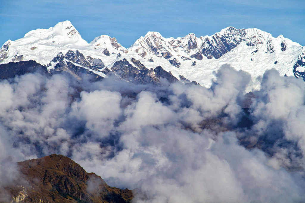
Approach to the Apurímac Canyon → night in the puna under a sky full of stars.
Steep Descent to the Apurímac (1,500–1,800 m) → intense heat, followed by a demanding ascent.
Final Ascent to Choquequirao (3,050 m) → triumphant entrance to the sacred city.
Full Day at Choquequirao → explore terraces, temples, and the famous Llama Terrace.
Exit via Cachora or Huanipaca → return to the “modern world.”
Duration: 7–9 days (extended to Machu Picchu: 9–12 days)
Distance: 60–70+ km
Maximum Altitude: ~4,600 m (15,100 ft)
Difficulty: High. Hikes can reach 1,000–1,500 m (3,300–4,900 ft) of elevation gain in a single day
Recommended Season: May–September (dry and more stable weather)
Permits: No quotas like the Inca Trail, but tickets are required for Choquequirao and Vitcos/Ñusta Hisp’ana
Sunscreen SPF 50+ and category 3–4 sunglasses (UV radiation at high altitude can be up to 40% stronger)
Layered clothing: base thermal layer, fleece, windbreaker, and waterproof poncho
3-season tent and sleeping bag rated for -5 to -10 °C (23–14 °F)
Trekking poles and mid-height hiking boots
Offline GPS, water filter, and a complete first-aid kit
Most importantly: 2–3 days of acclimatization in Cusco before the trek
Nature Along the Route
Here you’ll experience firsthand the transition of ecosystems:
From the cold puna, with golden ichu grass and hopping vizcachas.
To the cloud forests, filled with orchids, mosses, and hummingbirds.
And descending to the Apurímac, the climate changes drastically: scorching heat, cacti, and dry vegetation.
All of this in just a few hours of hiking.
The white rock of Ñusta Hisp’ana was set on fire by friars in the 16th century; its black scorch marks can still be seen.
Hiram Bingham identified Vitcos in 1911 and followed this same path while searching for Vilcabamba.
Choquequirao is considered the “sister city” of Machu Picchu, yet it receives only a handful of visitors each day.
Technically, yes, but only recommended for experienced mountaineers. Ideally: a guide and local porters.
Yes, but always purify it. Bring a water filter and purification tablets.
June–August for dry weather. May and September offer stable conditions with lusher, greener landscapes.
The Vitcos–Choquequirao trek is more than just a hike—it’s a bridge between two worlds. You start with the story of resistance in Vitcos, cross mountains that seem endless, and end at Choquequirao, a city that still holds the mystery of the Incas.
It’s demanding, yes. But few experiences in the Andes offer this unique mix of landscape, culture, and epic adventure.
If you’re looking for more than just a simple trek… this is the path.
Search